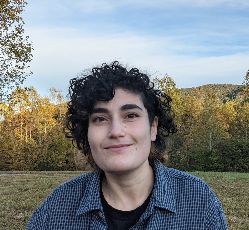
Kela Caldwell
Kela Caldwell (she/her) is a PhD candidate in Geography with a PhD minor in History, focused on 20th century developments of race and citizenship in the United States. Her dissertation project examines Black Women's club organizing and activism around anti-lynching legislation at both the national and local scales and seeks to identify how Black women shaped ideas about race, the law, and the role of the state in preventing violence.
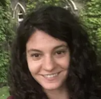
Tara Di Cassio
Tara L. Di Cassio is a Ph.D. Candidate in the Department of Geography and Environment at The University of North Carolina at Chapel Hill. Her dissertation examines Palestinian-authored graffiti/street art in Jordan and the West Bank, exploring how artists use walls as a resource to perform decolonial aesthetic practices. Tara’s research draws on Palestinian Studies and Indigenous and Black Geographic theories and methodologies to understand how these practices assert territorial rights, Indigenous sovereignty, and envision liberatory futures across fragmented geographies. Inspired by the multimodal archiving of this art by Palestinian artists and community members on social media, she is developing an archive of Palestinian-authored graffiti/street art in collaboration with volunteers in Jordan and the West Bank.
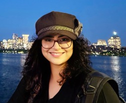
Zhuoma Gadou
Zhuoma Gadou is a PhD student in the Department of Geography at the University of Colorado Boulder. Her dissertation project engages with food geography, political economy, and development geography to understand the impacts of the global food regime on pastoral peoples. Her research centers on the experiences and agency of Tibetan pastoralists in relation to two commodity chains: locally produced yak meat and imported beef. Through this research, she aims to produce socially impactful scholarship that incorporates community engagement activities, prioritizes community input, and creates work that resonates with both academic and public audiences.
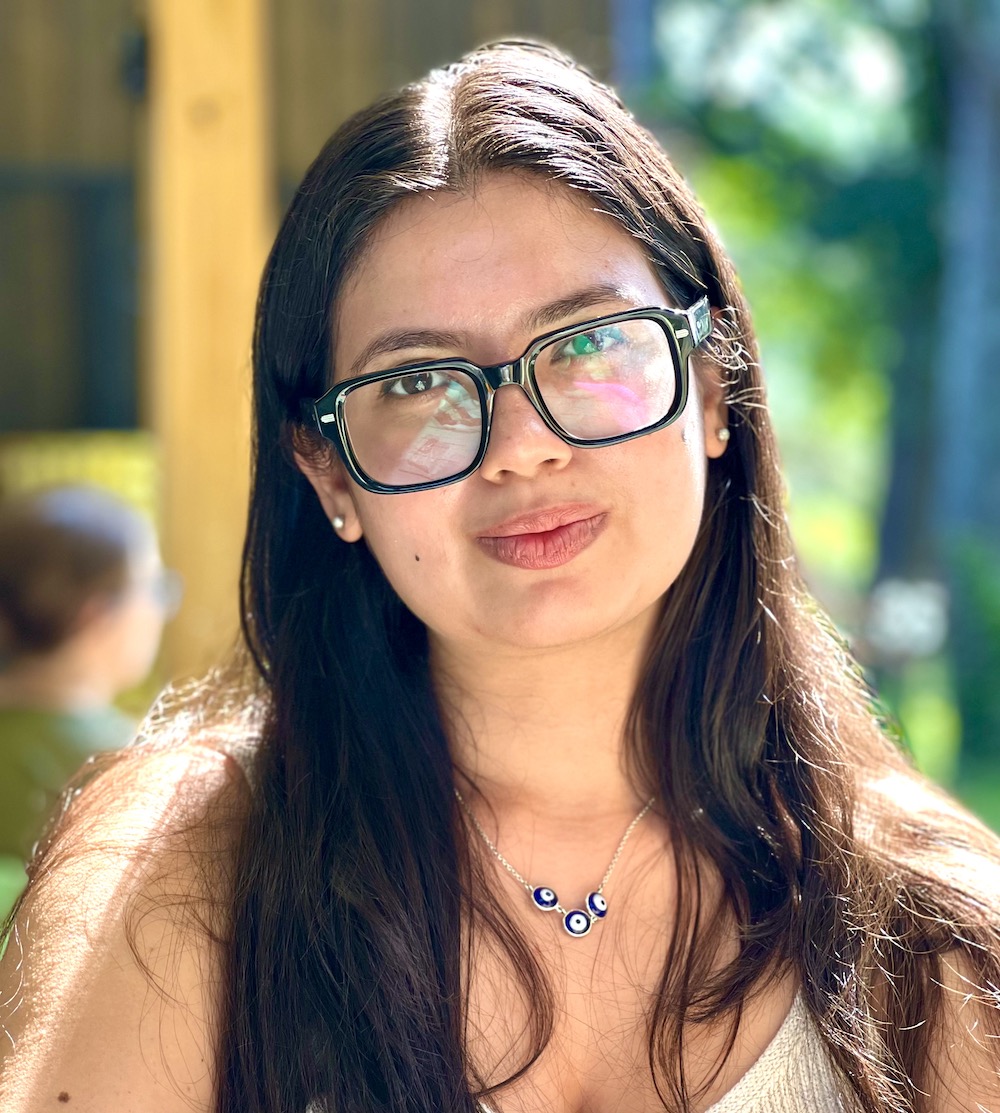
Colleen Henegan
Colleen Henegan at the University of Wisconsin-Madison. Her dissertation integrates predictive climate change models and geospatial analyses with community-based research with farm cooperatives across the Zambia's diverse agroecological regions. More specifically, she seeks to understand (1) how climate change will influence maize and indigenous staple crops - like millet, and sorghum - under future climate scenarios, and (2) how adaptations at multiple scales (local, regional, national) can influence the trajectories of these crops. By mixing methods - specifically machine learning, contextualized grounded theory, community-based research, and land suitability analyses - Colleen hopes to holistically analyze the interdisciplinary challenge of growing food in a changing climate. She aims to provide policy recommendations that are both scientifically accurate and relevant to stakeholders. She works closely with Zambia's Department of Crop Science and the Department of Meteorology to co-develop tools that are useful on multiple scales — from academic research to policy development to local climate change adaptation. She hopes to continue this work after graduation as a university faculty member. In her free time, Colleen enjoys riding along Madison's beautiful bike paths, gardening, hosting dinner parties, and taking long walks with her dog.
Suad Jabr
Suad Jabr is a PhD candidate in Geography & Environment at the University of North Carolina at Chapel Hill. Suad’s dissertation examines how queer forced migrants and their supporters navigate a variety of organizations, agencies, and offices to access resources, find community, and make life during and after resettlement in the US South. By positioning resettlement as an active and ongoing political process, Suad’s research studies how LGBTQ+ migration impacts shifting sexual and gender dynamics of the US South. In this work, Suad brings queerness into conversation with migration to imagine new, divergent, and transformative possibilities in political geography and beyond.
Hannah Kass
Hannah Kass is a joint Ph.D. candidate in the Department of Geography and the Nelson Institute for Environmental Studies at the University of Wisconsin-Madison. Her research focuses on the relationship between state repression and enclosure in struggles for food, land, and abolition. She also examines how eco-defenders and abolitionists prefigure alternative life-worlds beyond and against property, resource grabbing, and authoritarian statecraft. Blending autoethnographic research as a criminalized forest defender with state and movement document analysis, her doctoral dissertation explores her research interests in the context of the Stop Cop City/Weelaunee forest struggle: an autonomous and decentralized movement fighting deforestation for the development of a militarized police training facility in DeKalb County, Georgia. Her work has been published in Political Geography, Antipode, Dialogues in Human Geography, The Journal of Peasant Studies, and Agriculture and Human Values. A draft of her article published in Political Geography, “Police statecraft and post-property possibilities in the Weelaunee forest struggle,” was the winner of the 2025 PhD-level Graduate Student Paper Award in the Socialist and Critical Geography Specialty Group of the American Association of Geographers. She was also selected for an Advanced Achievement in Teaching Award from the University of Wisconsin-Madison Graduate School and College of Letters and Science. Outside of her academic work, Hannah is an avid improv comedian, strength athlete, collage artist, and gardener.
Fatemeh Kordi
Fatemeh Kordi is a Ph.D. student in Geography at Clark University, focusing on AI-driven wildfire risk prediction. Her research integrates satellite imagery, weather data, climate, and socioeconomic factors to enhance wildfire risk prediction accuracy in California, one of the most fire-prone regions in the U.S. Using cutting-edge deep learning techniques, such as Graph Convolutional Networks (GCN) and Temporal Convolutional Networks (TCN), Fatemeh’s work captures the spatial and temporal dynamics of wildfires. This hybrid AI model aims to provide real-time, actionable insights for wildfire management, improving decision-making and resilience. Fatemeh’s long-term goal is to contribute to global disaster risk reduction and environmental sustainability efforts, with a focus on leveraging AI for environmental prediction and resilience.
Mansi Kumar
Mansi Kumar is a PhD candidate in the Urban Studies Institute at Georgia State University. She earned her M.Sc. in Urban and Regional Planning from Heriot-Watt University and her Bachelor of Construction Technology from CEPT University. Her doctoral dissertation examines the spatial (im)mobility of women beauty professionals working with digital platforms in Mumbai. It investigates how platform regulations, socio-cultural norms, and urban infrastructure shape their everyday movement through the city, while also highlighting the forms of agency women exercise within these constraints. Her research builds on feminist and urban scholarship to examine the complex relationship between spatial (im)mobility and gendered labor in fast-evolving urban environments.
Emily McDonnell
Emily McDonnell is a proud citizen of the Navajo Nation. She currently lives in North Carolina where she is a 5th year PhD candidate in American Studies with a concentration in American Indian/Indigenous Studies at UNC Chapel Hill. Her dissertation, “ReMapping a Monument: Identity, Landscape, and Culture in Monument Valley” explores the iconic landscape through the perspectives of residents and cultural workers in the area. Her dissertation is heavily informed by her lived experience growing up on the Navajo reservation, as well as her encounters with stereotypes about Native people that are manufactured by the film and tourism industry. As a passionate storyteller, she intends to work in the cultural heritage sector as a researcher, consultant, and advocate for culturally responsive tourism led by Native communities. Emily also holds a bachelor’s degree in Literacy, Learning, and Leadership with a minor in American Indian Studies from the University of Arizona, and master’s degree in Public Administration (MPA) from Arizona State University.
Jewon Ryu
Jewon Ryu is a Ph.D. candidate in the Graduate School of Geography at Clark University. Her work explores the intersection of Urban Geography, Political Ecology of Energy, and Transition Studies, focusing on the social and cultural dimensions of nature, energy, and technological transition. Her dissertation, tentatively titled “Perceptions and Benefits of Post-Construction offshore wind farms in Cape Cod, MA, USA, and Jeju Island, South Korea” investigates how different models of community benefits—corporate-led versus NGO-driven—shape the evolving social acceptance of offshore wind farms. By analyzing these contrasting governance structures, she examines how capital-intensive energy transitions both reinforce and challenge existing patterns of commodification, enclosure, and local participation. Supported by the Evelyn L. Pruitt fellowships, her research contributes to broader discussions on how renewable energy development projects can align more closely with democratic governance through benefit-sharing practices.
Nicole Trenholm
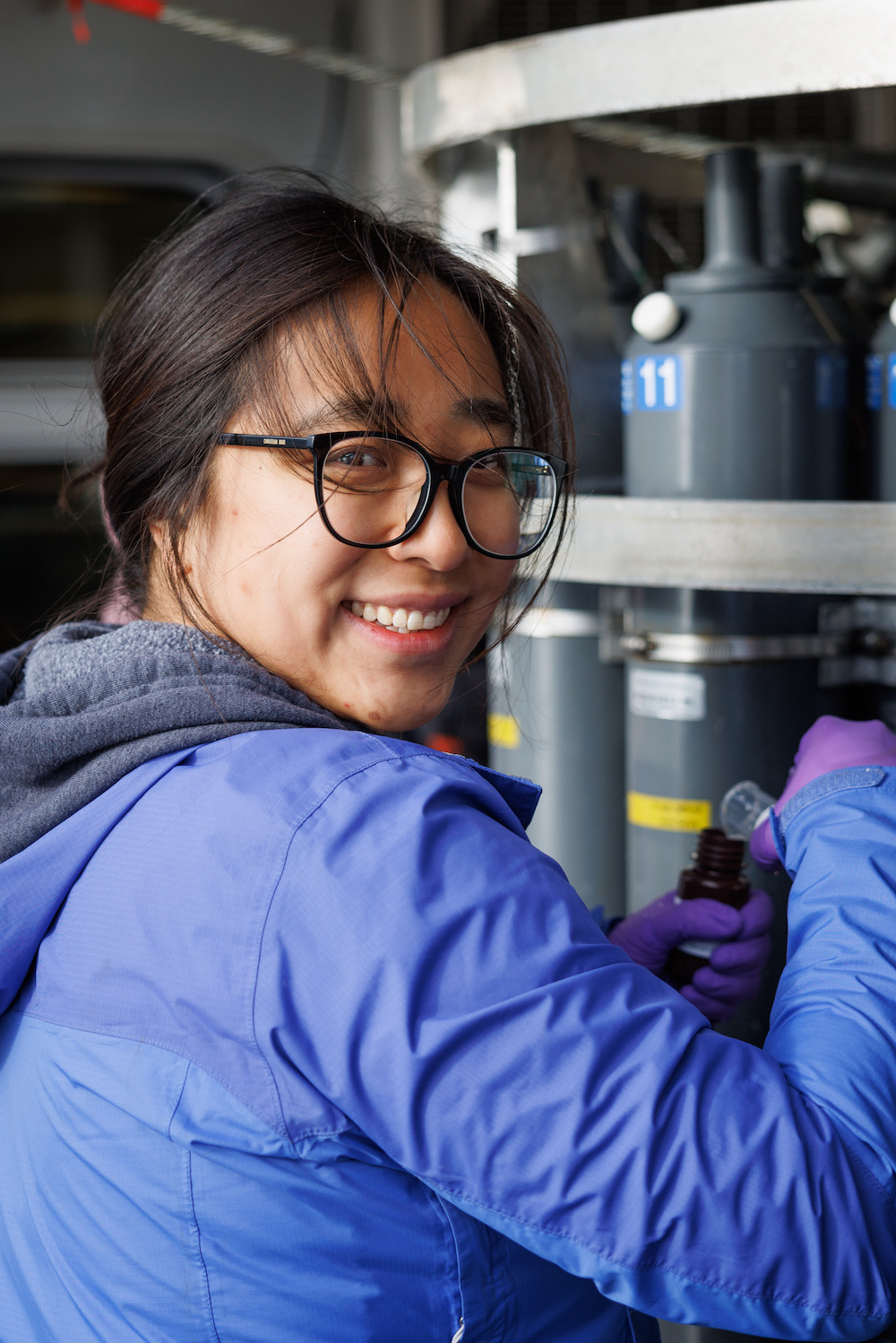
Nicole Trenholm, is an oceanographer, sailing her non-profit's (Ocean Research Project) science schooner, the SRV Marie Tharp to investigate climate change cause and effects on the coastal glaciated ecosystem of the Arctic. After a decade of polar campaigns and bearer of the SWG flag, she is at the tail end of her doctoral research study and will address the role coastal glacial fjords and nearshore regions play as a natural carbon sink. Nicole will return from leading a summer campaign this Fall to prepare her field geochemical and physical ocean observations to compare then make suggestions on improvements of an air-sea carbon flux model product (ECCO-DARWIN). She will conduct this assessment in early 2026 during an in-residence stay at the Jet Propulsion Research lab. The Arctic's warmth is accelerating and the glacial meltwater impacts marine ecosystem livelihood. Nicole aims to address how glacial meltwater influences ocean carbon uptake with support from her advisory at University of Maryland Center for Environmental Science, University of Santa Cruz, and Smithsonian Environmental Research Center. She enjoys science and arts collaborations and supporting like-minded missions, or joining in on outdoor recreation, beyond sailing.
Tenzin Yangkey
Tenzin Yangkey is a PhD student in the Geography Department at the University of Colorado, Boulder. Her dissertation investigates the promises and politics of solar park development in Ladakh, India, with a focus on development aspirations and political ecologies shaping the Indo-Tibetan borderland. This dissertation builds upon her earlier research on climate change impacts among Tibetan refugee pastoralists in Changthang, Ladakh. Yangkey holds a Master’s in Geography from the University of Arizona and a Bachelor’s in Environmental Engineering from Duke University. Her work contributes to critical conversations on energy justice, Indigenous sovereignty, and environmental change in the Himalayan region.
Anna Zhu
Anna Zhu is a PhD student in the Clark University Graduate School of Geography. Her research examines how phytoplankton (marine algae) are being affected by environmental changes in the Bering and Chukchi Seas. She works closely with the Distributed Biological Observatory (DBO) program through her advisor's Polar Science Research Laboratory. She is passionate about climate change research in the Arctic, hoping her project can contribute to a better understanding of our changing oceans. In her spare time, she enjoys running, swimming, and exploring the great outdoors.
Oforiwaa Pee Agyei-Boakye
Oforiwaa Pee Agyei-Boakye is a Transport Geography doctoral researcher at the University of Minnesota, Twin Cities. She studies the spatial impacts of public transportation, particularly assessing the impact of Bus Rapid Transit (BRT) investments on travel patterns in African cities. She also focuses on BRTs' broader relevance to spatial accessibility, mobility, and informal transport systems. Her long-term goal is to contribute to sustainable transportation networks that meet the fast pace of urbanization in Africa.
Jenny Bueno
Jenny Bueno is a PhD candidate at Florida State University in Tallahassee, Florida. She is passionate about understanding changes in coastal habitats that are driven by human activities and climate change. Jenny’s dissertation research focuses on using remote sensing to document these changes. She is studying how drones can be used to monitor intertidal oyster reefs in the Apalachicola Bay region of Florida, where oyster populations have been declining. This approach will help practitioners quickly assess reef status to make informed management decisions. Jenny is also researching mangrove expansion at their northern limit in Apalachicola Bay, Florida. Specifically, she is examining how quickly mangroves have expanded over the last decade using aerial imagery and she is analyzing the spatial distributions of two species, red and black mangroves, and how these species are displacing saltmarsh vegetation. She hopes this research will assist with predicting where mangroves will continue to establish in a changing climate.
Hannah Friedrich
Hannah Friedrich is a PhD candidate in the School of Geography, Development, and Environment at the University of Arizona. Her dissertation explores aligning satellite-based indicators of post-hurricane recovery with interviews and administrative records on heirship property, households’ use of homeowners insurance, and litigation with insurance companies in Southwest Louisiana. Applying mixed methods, her research aims to identify the socio-legal limitations households face in addressing losses from extreme events and how this creates uneven geographies of recovery. Friedrich’s long-term research agenda is to work alongside disaster-impacted communities to translate inequities documented with various data sources to policymakers and advocate for more just climate adaptation. She earned her Master’s in Geography from Oregon State University and her Bachelor’s in Geography and Geographic Information System/Cartography from the University of Wisconsin-Madison.
Tamar Law
Tamar Law is a PhD student at Cornell University in Global Development. She holds an MPhil in Human Environmental Geography from the University of Oxford. Her research examines the politics of climate governance in Southeast Asia. This dissertation interrogates the politics of mangrove restoration in Indonesia’s new low-carbon development plan through Blue Carbon governance. Law examines how new forms of speculative climate governance and land valuation via the financing of Blue Carbon inform agrarian change in Indonesia. Through multi-sited ethnography, Law examines how scientific expertise, financial investment, and social relations inform the socio-technical process of mangrove restoration. Law considers how Blue Carbon governance developed at a national scale is locally experienced, evaluating the local livelihood, labor, and land-use impacts of the State-led Mangrove for Coastal Resilience Project (M4CR) in the Mahakam Delta, home to Indonesia’s largest and most degraded mangrove systems.
Mirella Pretell
Mirella Pretell is a Peruvian political ecologist and decolonial feminist. She is a woman geographer of Quechua Indigenous descent, born and raised in Peru. She's a Ph.D. Candidate in Geography at Syracuse University, specializing in political ecology, feminist geography, and postcolonial and Indigenous geographies. With over a decade of experience in environmental-related issues and in-ground expertise in the Andes Amazon, she is deeply committed to environmental justice and has a longstanding engagement with Indigenous peoples. She was Head of the Amazon's Loreto Office of Peru's Environmental Protection Agency. She also worked for UNDP in implementing the Joint Declaration of Intent between Peru, Norway, and Germany to reduce deforestation in the Amazon, among other Amazon-related initiatives. Her work focuses on gender, Indigenous movements, resource extraction, and environmental justice. Her research builds upon a long-lasting partnership with the Indigenous Women's Organization Huaynakana Kamatahuara Kana.
Sahithya Venkatesan
Sahithya Venkatesan is a PhD candidate in the Department of Geography at Rutgers University. Her dissertation research, funded by a Junior Fellowship from the American Institute of Indian Studies and the Evelyn L. Pruitt National Fellowship for Dissertation Research, investigates the historic place-making practices of marginalized Dalit communities in the Cauvery Delta, with a broad focus on the political ecologies of caste, agrarian political economy, and climate change. Sahithya holds a master's degree in Development Studies from the Indian Institute of Technology Madras, where she specialized in urbanization and development. Prior to her doctoral studies, she worked at the Center for Policy Research and the Abdul Latif Jameel Poverty Action Lab (J-PAL), two leading institutions in development policy. Her work aims to contribute to a deeper understanding of social and environmental justice in South Asia.
Poonam Suresh Argade
Poonam is a PhD Candidate (Social Sciences) in the Maxwell School of Citizenship and Public Affairs at Syracuse University. She is interested in environment and development politics and draws on transnational, decolonial, and Dalit-Bahujan feminisms, urban geography, and critical development studies.
Her doctoral research with the Pani Haq Samiti (Water Rights Campaign) delves into how Mumbai’s water organizers advance an alliance-based politics for water justice with a focus on access in informal settlements. For examining the emergence of water ontologies rooted in regional histories of difference(s) along caste, religion, class, and gender, this project deploys feminist ethnography and collaborative writing methods. Further, Poonam is also working on a publicly available video archive of organizers’ stories developed in conversation with the collective. In her spare time, Poonam likes to indulge in TV dramedies, food and karaoke.
Ellie Cleasby
Ellie Cleasby (she/her) is a PhD Candidate in Geography at the University of Washington, Seattle. Her current research considers the unequal global burdens generated by large volumes of clothing waste, particularly along economic, social and environmental lines. She is particularly interested in the ways that people in Ghana, the US and the UK are employing practices of making and mending clothing to subvert the fast fashion industry. An interest which stems from her own participatory fashion practices. Broadly, she is thinking about the role of care in subversive practices that produce more sustainable futures.
Lauren Gerlowski
Lauren Gerlowski is a human geography PhD Candidate in the Department of Geography at the University of Wisconsin-Madison under the direction of co-advisors Dr. Kristopher Olds and Dr. Stephen Young. Her dissertation project engages with urban geography, feminist political economy, and cultural industries to address how neoliberal urban economic policy affects and is challenged by dancers, dance, and urban space in the global city of Chicago, IL. This dissertation is motivated by her background in professional concert dance where she performed and choreographed in modern, contemporary, tap, and musical theater productions. This firsthand knowledge informs her research questions and passion to understand the socio-spatial dynamics of dance and the urban political economy. Beyond her dissertation project, Lauren has been recognized for her commitment to student-centered pedagogy when she was awarded a Teaching Fellows Award by the University of Wisconsin-Madison College of Letters and Sciences.
Lauren R. Pearson
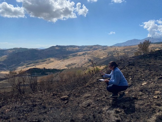
Lauren R. Pearson is a PhD Candidate in the Geography Department at the University of California, Berkeley. She received her M.A. from the University College London and her B.A. from New York University. Her dissertation “Land on Fire: Crisis, uneven development, and new southern questions in Mezzogiorno Italy” explores the intersection of crisis, austerity, uneven development, and mafia related crimes within the phenomena of illegally set wildfire in north-central Sicily. Her research has been supported by Trinity College's Research Grant in Modern Italian History (the “Barbieri” Grant), The Foreign Language and Area Studies (FLAS) Fellowship, The Berkeley-Naples Fellowship, Università degli Studi di Napoli-Federico II, the Society of Women Geographers’ Evelyn L. Pruitt Fellowship, and the Department of Geography, University of California, Berkeley.
Mandy Truman
My name is Mandy Truman. I am a doctoral candidate in the Department of Geography and Environmental Studies at Texas State University in San Marcos, Texas. My graduate studies have focused on cultural geography, Black Geographies, music geography, and cultural economy. My project focuses on the Mississippi Delta region and the uneven development of the blues tourist economy in Clarksdale, Mississippi. I was drawn to this region from my very first visit by the people I met, the music I heard, the places I experienced, the interactions I encountered, and wanting to understand the long history of racism that remains visible in many ways. The city is rich in blues and civil rights history, specifically in what was historically the Black side of town, known as the New World District. Blues tourism has been the focus of the city’s economic growth. Blues tourism developed in downtown Clarksdale where buildings have been restored and new businesses have been established. Downtown Clarksdale is historically known as the white side of town, where blues music would’ve never been heard during the Jim Crow era. Blues music evolved, developed, and could be heard on every corner in the New World District since its establishment in the early 1900s, where Black businesses thrived and supported the community. With every visit I have made to Clarksdale, the number of mostly white-owned businesses downtown has continued to grow, while the number of demolished buildings and empty lots in the New World District also continued to grow. This project focuses on understanding the history of the New World District, what it meant to the Black community members that lived there, and hearing the valuable memories that remain with residents who still have stories to share. This project will also examine the uneven development of the city’s blues tourist economy and why there has been no effort made to preserve the historic Black part of town, while downtown Clarksdale continues to grow and benefit from the Black culture and traditions that were born in the New World District.
Nicole Tu-Maung Venker
Nicole T. Venker is a doctoral candidate in Cornell University's Department of Natural Resources and the Environment. Her research examines livelihoods, labor, and land relations along transnational routes of migration that span Myanmar (Burma), Thailand, and to the United States. As a critical, feminist geographer, Nicole uses qualitative, visual, and participatory methods to tell human stories about the environment. Her dissertation project, tentatively titled, “Living off the Land: Migration from Myanmar and the Dislocations of Nature in Refugee Lives” traces Myanmar migrants shifting relationships to land in the context of armed conflict, forced displacement, and refugee migration. Her work focuses on how migrants experience, envision, and renegotiate their relationship to land within sites of resettlement, and in a transitioning Myanmar. Along transnational routes of refugee migration, she investigates structures of mobility, changes in everyday practices of subsistence, labor, and leisure, as well as migrants’ visions of environmental and social justice. The Evelyn L. Pruitt Dissertation Research Fellowship will allow Nicole to conduct 7 months of policy and grounded fieldwork in Thailand.